To get a fuller picture of what it’s like to live on the Island, it can be handy to be armed with a bit of general Island knowledge about what’s here— and what’s not!
For a start, where is it?

D’Urville Island, or Rangitoto ki te Tonga (meaning red, or blood-coloured sky of the South), is New Zealand’s eighth largest island and is located at the Northern-most tip of the Marlborough Sounds at the top of the South Island.
The Island’s narrow 150 km2 is a patchwork of farmland, pine forestry blocks, and regenerating native bush, spreading over a steep, rugged terrain that culminates with Mount Attempt at 729m. There are two large harbours on the west coast which break up the sandy bays, rocky coves, and sheer cliffs that form the coastline.
History and French Pass
The Pākehā name of ‘D’Urville’ comes from Jules Dumont d’Urville, the Admiral in the French Navy who, in 1827, damaged his ship when attempting to cross the 500m channel of water that separates the Island from the mainland.
This is no ordinary stretch of salt water! Now known as French Pass, it contains the fastest tidal flows in New Zealand, reaching 8 knots (or 4 m/s), and has been responsible for many a marine disaster—supposedly, it’s even strong enough to stun fish.
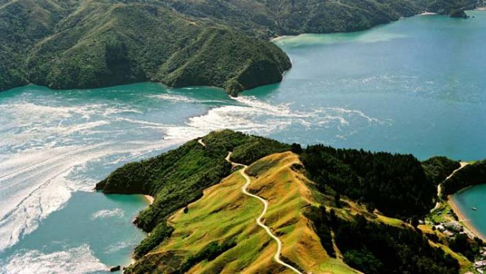
French Pass, however, was no match against the human determination to explore and settle, and the Island boasts a rich Maori history – the natural deposits of argillite being prized for making tools and weapons. Up until a few hundred years ago it is estimated that as many as 600 souls lived here, but this, inevitably, gave way to slash and burn gangs and a focus on farming.
No possums!

Amazingly, possums never made it here—and neither did rabbits, wild goats or ships rats. This gives the Island a unique biodiversity and makes it home to over 29 species of bird including the blue penguin and one of the worlds rarest sea bird: the King Shag. With a strong focus on conservation, DOC (Department of Conservation) manage a 6000 ha reserve and there is an island-wide stoat eradication program in full swing.
With that being said, Red Deer managed to swim across and, along with introduced Fallow Deer and wild pigs, they maintain a very healthy population. This makes the Island a popular destination for recreational hunters.
The Wind
The Island juts firmly out into the Cook Straight—the narrow gap that separates New Zealand’s North and South Islands—putting it directly in the path of the extreme weather that rushes through. Although the steep terrain offers some shelter, nothing can stop the wind if it’s blowing directly on shore! That’s not to say it’s always windy here, but when it blows, it really howls!
Island Life
D’Urville is now one of the most expensive places in New Zealand to farm (bringing stock on and off the Island requires a barge to come out from Havelock) and only three large farms remain at the centre of the steady population of 50 (ish) permanent Island residents.
But we do have roads – and a mail service!
60km of unsealed roads came to the island in 1967 and electricity in 1975—though both only service main areas and are expensive to maintain. There are still a few properties that remain ‘boat access only’ and even more that rely on solar panels and generators for their power.

Everyone gets mail though! Island residents have private bags that are stored in Rai Valley and then brough over by boat every Tuesday and, weirdly, we don’t even get charged for rural delivery. Tuesday as mail day is our family’s only scheduled event of the week!
An increase in traffic
Eight years ago a drive-on drive-off barge service became available which, for the first time, made it easy for vehicles to be brought across the water—before that it was a winch and tackle job. Though this increased the accessibility for adventurous tourists, it’s still rare to meet another vehicle on the road.

Not a shop in site
All supplies needed for living have to be brought over—yep, that includes fuel. How each resident approaches this task varies, but everyone is fully aware that there is no ability to simply ‘pop’ to town for a loaf of bread!
The Wilderness Resort, nestled in a south-east bay, does have a seasonal café, but it is accessed by boat only and therefore mostly services the summer tourists who are out for a cruise or a spot of fishing—and honestly, using the Island’s winding roads, it would take us an hour to drive there anyway.
A home education
Although various small schools have been established in the last hundred years, nowadays the Island’s population of children rarely exceeds a scattered handful, leaving each family to make their choice between home schooling (that’s us), correspondence school, or boarding on the Mainland.
Whatever the choice, D’Urville’s rich biodiversity and spectacular terrain makes for a pretty idyllic childhood. Living here certainly takes us back to the raw power of nature and the simplicity of basic needs. It’s exhilarating, yet chilled, and certainly never boring!
- Why the Mumma learned to motorbike

- From Private Bag to doorstep: the epic journey of our mail
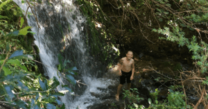
- Sourcing our drinking water from the top of a waterfall—now that’s refreshing!
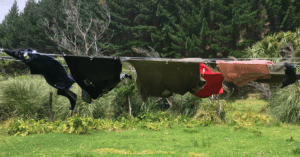
- How to hang out washing in 60 km/h winds
- We found the best use for a mussel buoy—ever!
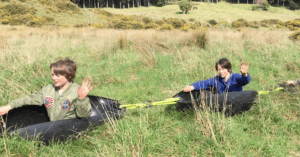
- What we caught in the pig trap (hint: It wasn’t a pig!)


Wow, that certainly seems like a lifetime ago!! Great to hear from you guys, glad to know you’re doing well. I bet Ben and Ton are having a blast where they are – there’s so much beautiful wilderness in this country. It would be lovely to touch base with them at some point – so many childhood memories! Take care guys xx
Hi Rethenwyn. A long way from Katy and design and technology classes at Mountbatten. Your Dad sent us your blog for which Jo and I are very grateful. No doubting who Dad is and who is the mother of your children. What a strong family likeness. All beautiful. Strange that you are on an island on the north end of South Island as Tom and Ben are building on Stewart Island on the southern end. With a very similar boat too. Lovely to hear how you are getting on. Jo and Graham